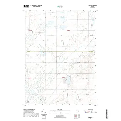
2019 Map of Twin Lakes
USGS Topo · Published 2019About this map
Glenwood serves as the primary settlement node in this corner of southwestern Michigan, where the boundary between Van Buren and Cass counties divides a landscape defined by glacial hydrology. The Dowagiac River and the Dowagiac Drain system dominate the southern half of the sheet, illustrating the region's managed water flow through low-lying marshlands. This map is particularly valuable for genealogical research, as it identifies several distinct burial grounds including North Wayne Cem, Red Mill Cem, Gage Cem, and White Cem. These cemeteries are scattered across a patchwork of section lines and rural roads like Territorial Rd W and Celery Center Rd. Northward, the terrain transitions into a dense cluster of water bodies including School Lake, Pine Lake, Osborn Lake, and the larger Lake of the Woods, reflecting the area's enduring character as a destination for inland lake recreation and agriculture.
Find a feature on this map
49 named features on this map. Tap any name to fly to it.
Don’t see what you’re looking for? This feature index may not catch every label — zoom into the map to look around manually.
Map Details
Editions of this 2019 Twin Lakes Map
This is the sole edition of this map. No revisions or reprints were ever made.
Other maps of this area

1927 · Hartford
USGS Topo · 1:62,500

1931 · Hartford
USGS Topo · 1:62,500

1944 · Marcellus
USGS Topo · 1:62,500

1945 · Cassopolis
USGS Topo · 1:62,500

1946 · Marcellus
USGS Topo · 1:62,500

1947 · Cassopolis
USGS Topo · 1:62,500

1948 · Vandalia
USGS Topo · 1:62,500

1949 · Vandalia
USGS Topo · 1:62,500

1953 · Fort Wayne
USGS Topo · 1:250,000

1953 · Chicago
USGS Topo · 1:250,000