
1952 Map of Twin Lakes
USGS Topo · Published 1953About this map
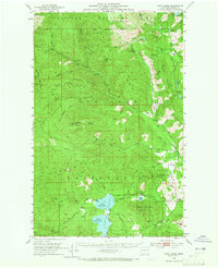
Colville Indian Reservation lands dominate this mid-century survey, revealing a landscape defined by ranching outposts and high-altitude lookouts. Settlement is sparse, clustered primarily in fertile valley pockets like Seylor Valley Creek and near the prominent Twin Lakes. The presence of Lakeside Grange and scattered family holdings such as Chief Barnaby Ranch and Banning Ranch indicate a persistent agricultural presence in Ferry County.
Find a feature on this map
73 named features on this map. Tap any name to fly to it.
Don’t see what you’re looking for? This feature index may not catch every label — zoom into the map to look around manually.
Map Details
Editions of this 1952 Twin Lakes Map
2 editions found
Other maps of this area

1904 · Republic
USGS Topo · 1:125,000

1936 · Marcus
USGS Topo · 1:96,000

1942 · Marcus
USGS Topo · 1:125,000

1948 · Republic
USGS Topo · 1:62,500

1948 · Sherman Peak
USGS Topo · 1:62,500

1948 · Kettle Falls
USGS Topo · 1:62,500

1948 · Hunters
USGS Topo · 1:62,500

1948 · Wilmont Creek
USGS Topo · 1:62,500

1950 · Wilmont Creek
USGS Topo · 1:62,500

1950 · Hunters
USGS Topo · 1:62,500