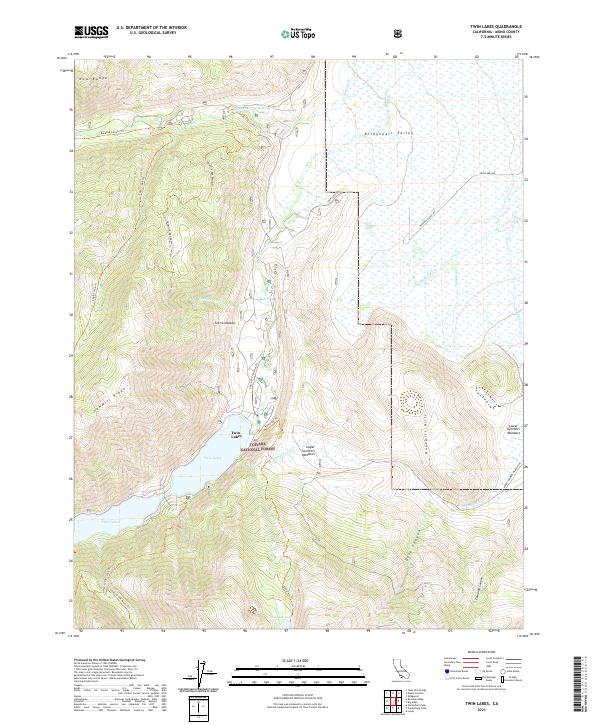
2021 Map of Twin Lakes
USGS Topo · Published 2021About this map
Bridgeport Valley and the surrounding peaks of the Sierra Nevada define this section of Mono County within the Toiyabe National Forest. The landscape is centered on the prominent Twin Lakes, which serve as a focal point for the local drainage system including Robinson Creek and Buckeye Creek. This recent survey illustrates a network of backcountry access points, such as the Buckeye Canyon Trail and the Sawmill Ridge Route Trail, that connect high-elevation features like Tamarack Lake and the Sawmill Ridge. Geothermal activity is noted at Buckeye Hot Spring in the northern reach of the map, while the eastern portion is shaped by the Hunewill Hills and the winding course of the East Walker River. The map details various meadowlands including Upper Summers Meadows and Lower Summers Meadows, reflecting the seasonal grazing and water management patterns typical of the eastern Sierra slopes.
Find a feature on this map
39 named features on this map. Tap any name to fly to it.
Don’t see what you’re looking for? This feature index may not catch every label — zoom into the map to look around manually.
Map Details
Editions of this 2021 Twin Lakes Map
This is the sole edition of this map. No revisions or reprints were ever made.
Other maps of this area

1909 · Bridgeport
USGS Topo · 1:125,000

1911 · Bridgeport
USGS Topo · 1:125,000

1920 · Bridgeport
USGS Topo · 1:125,000

1948 · Walker Lake
USGS Topo · 1:250,000

1954 · Fales Hot Springs
USGS Topo · 1:24,000

1956 · Fales Hot Springs
USGS Topo · 1:62,500

1956 · Matterhorn Peak
USGS Topo · 1:62,500

1957 · Walker Lake
USGS Topo · 1:250,000

1958 · Bodie
USGS Topo · 1:62,500
1958 · Bridgeport
USGS Topo · 1:62,500