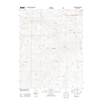
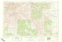
2013 Map of Twin Mountains
USGS Topo · Published 2013About this map
Lost Treasure Diggings sits tucked within the eastern reaches of the Rio Grande National Forest, a reminder of the prospecting history that defines this corner of Saguache County. The landscape is carved by steep drainages like Cañada Hondo and Coolbroth Canyon, feeding water into La Garita Cr and Old Woman Cr. A network of historic routes, including the La Garita Sd. Trail 787 and the La Garita Creek Trail 793, provides access to the high country surrounding Blue Mountain and Eagle Mountain. This 2013 survey illustrates a transition from the narrow gulches of Usevia Gulch to the broader expanse of English Valley. Notable landmarks such as La Garita Corral and La Ventana mark the edges of these rugged foothills, while Sunday Spring and Ridge Spring represent vital water sources for local ranching and transit in this arid mountain terrain.
Find a feature on this map
28 named features on this map. Tap any name to fly to it.
Don’t see what you’re looking for? This feature index may not catch every label — zoom into the map to look around manually.
Map Details
Editions of this 2013 Twin Mountains Map
This is the sole edition of this map. No revisions or reprints were ever made.
Other maps of this area
1914 · Creede
USGS Topo · 1:125,000
1915 · Del Norte
USGS Topo · 1:125,000
1916 · Creede
USGS Topo · 1:125,000
1917 · Del Norte
USGS Topo · 1:125,000

1945 · Durango
USGS Topo · 1:250,000

1953 · Durango
USGS Topo · 1:250,000
1954 · Durango
USGS Topo · 1:250,000
1961 · Durango
USGS Topo · 1:250,000
1963 · Durango
USGS Topo · 1:250,000
1966 · Durango
USGS Topo · 1:250,000