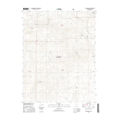
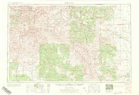
2016 Map of Twin Mountains
USGS Topo · Published 2016About this map
Rio Grande National Forest dominates this section of Saguache County, where high-elevation drainage patterns define the landscape. Water sources like Sunday Spring and Ridge Spring are scattered among the ridges, feeding numerous creeks and gulches. The terrain is marked by significant peaks, most notably the Twin Mountains and Eagle Mtn, which rise above the surrounding valleys. A network of primitive routes, including the La Garita Sd Trail and La Garita Creek Cutoff Trail, suggests a long history of cattle movement or backcountry access through this rugged interior. To the east, the geological feature La Ventana and the wide expanse of English Valley provide a distinct contrast to the more enclosed canyons like Coolbroth Canyon and Cañada Honda. This map captures a remote area where natural landmarks and ephemeral water sources remain the primary points of reference.
Find a feature on this map
26 named features on this map. Tap any name to fly to it.
Don’t see what you’re looking for? This feature index may not catch every label — zoom into the map to look around manually.
Map Details
Editions of this 2016 Twin Mountains Map
This is the sole edition of this map. No revisions or reprints were ever made.
Other maps of this area
1914 · Creede
USGS Topo · 1:125,000
1915 · Del Norte
USGS Topo · 1:125,000
1916 · Creede
USGS Topo · 1:125,000
1917 · Del Norte
USGS Topo · 1:125,000

1945 · Durango
USGS Topo · 1:250,000

1953 · Durango
USGS Topo · 1:250,000
1954 · Durango
USGS Topo · 1:250,000
1961 · Durango
USGS Topo · 1:250,000
1963 · Durango
USGS Topo · 1:250,000
1966 · Durango
USGS Topo · 1:250,000