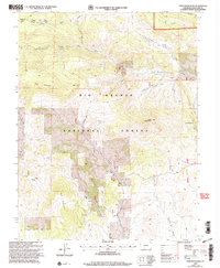
2001 Map of Twin Mountains
USGS Topo · Published 2005About this map
La Garita Corral stands as a primary point of human activity in this high-elevation landscape within the Rio Grande National Forest. This 2001 revision illustrates a rugged terrain defined by sharp drainage systems, where water sources like Castor Creek and Coolbroth Can carve through the mountainous topography of Saguache County. The map reflects a landscape primarily managed for natural resources and grazing, evidenced by the network of forest roads and the specific identification of livestock-related sites. The settlement pattern here is sparse, characteristic of the high-country ranching and forestry operations that have sustained the region for decades, providing a clear record of the area's land-use priorities at the turn of the millennium.
Find a feature on this map
3 named features on this map. Tap any name to fly to it.
Don’t see what you’re looking for? This feature index may not catch every label — zoom into the map to look around manually.
Map Details
Editions of this 2001 Twin Mountains Map
This is the sole edition of this map. No revisions or reprints were ever made.
Other maps of this area

1914 · Creede
USGS Topo · 1:125,000

1915 · Del Norte
USGS Topo · 1:125,000

1916 · Creede
USGS Topo · 1:125,000

1917 · Del Norte
USGS Topo · 1:125,000

1945 · Durango
USGS Topo · 1:250,000

1953 · Durango
USGS Topo · 1:250,000

1954 · Durango
USGS Topo · 1:250,000

1961 · Durango
USGS Topo · 1:250,000

1963 · Durango
USGS Topo · 1:250,000

1966 · Durango
USGS Topo · 1:250,000