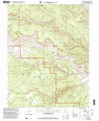
2001 Map of Twin Rocks
USGS Topo · Published 2003About this map
Capitol Reef National Park dominates this landscape, defined by the striking geological upheaval of the Waterpocket Fold. The small settlement of Fruita sits near the confluence of Sulphur Creek and the Fremont River, serving as a central point of activity near the Visitor Center. The terrain is characterized by high plateaus and deep incisions, including Spring Canyon and the massive Meeks Mesa, which towers over the northern section.
Find a feature on this map
49 named features on this map. Tap any name to fly to it.
Don’t see what you’re looking for? This feature index may not catch every label — zoom into the map to look around manually.
Map Details
Editions of this 2001 Twin Rocks Map
This is the sole edition of this map. No revisions or reprints were ever made.
Other maps of this area

1885 · Fish Lake
USGS Topo · 1:250,000

1896 · Fish Lake
USGS Topo · 1:250,000

1952 · Notom 2 NW
USGS Topo · 1:24,000

1952 · Notom 3 NW
USGS Topo · 1:24,000

1952 · Notom 2 SE
USGS Topo · 1:24,000

1952 · Notom 2 SW
USGS Topo · 1:24,000

1952 · Notom 4 NW
USGS Topo · 1:24,000

1952 · Notom 2 NE
USGS Topo · 1:24,000

1952 · Notom 3 NE
USGS Topo · 1:24,000

1952 · Notom 1 SW
USGS Topo · 1:24,000