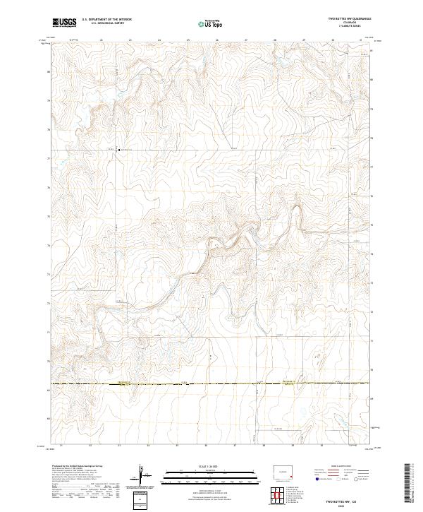
2022 Map of Two Buttes NW
USGS Topo · Published 2022About this map
The high plains of Southeast Colorado, specifically the borderlands between Prowers and Baca counties, are defined here by a network of ephemeral drainage systems. The meandering path of Two Butte Creek serves as a primary geographic anchor, cutting through the landscape alongside its namesake Two Butte Cr. To the north, the waters of N Butte Cr carve through the terrain, while Little Bear Cr occupies the southeastern corner of the quadrangle. For those researching local family history, the Hamilton Cem stands as a significant landmark, situated near the intersection of several section-line roads like Co RD F and Co RD 16. This map reflects the structured township-and-range system of the American West, where the landscape is systematically divided into grids that dictate the placement of both rural cemeteries and the county road network.
Find a feature on this map
27 named features on this map. Tap any name to fly to it.
Don’t see what you’re looking for? This feature index may not catch every label — zoom into the map to look around manually.
Map Details
Editions of this 2022 Two Buttes NW Map
This is the sole edition of this map. No revisions or reprints were ever made.
Other maps of this area

1891 · Albany
USGS Topo · 1:125,000

1892 · Two Butte
USGS Topo · 1:125,000

1893 · Two Butte
USGS Topo · 1:125,000

1893 · Albany
USGS Topo · 1:125,000

1955 · La Junta
USGS Topo · 1:250,000

1958 · La Junta
USGS Topo · 1:250,000

1968 · La Junta
USGS Topo · 1:250,000
1968 · North Plum Creek SE
USGS Topo · 1:24,000
1968 · Gobblers Knob
USGS Topo · 1:24,000
1968 · Barrel Spring
USGS Topo · 1:24,000