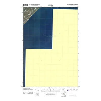
2010 Map of Two Harbors OE S
USGS Topo · Published 2010About this map
Lake Superior dominates this nautical-focused survey, defining the shoreline of Lake County in the early twenty-first century. The map centers on the open water of the Great Lakes, capturing the coastal transition where the North Shore terrain meets the water. Along the narrow terrestrial corridor in the northwest corner, the small settlement of Larsmont sits as a primary point of interest for local historians and genealogists. This area represents a classic stretch of the Minnesota coast where transportation and tourism intersect, evidenced by the proximity of the Wagon Wheel Campground to the major regional artery of Hwy 61. The inclusion of County Hwy 101 provides additional detail for those tracing the modern infrastructure of this lakeside community.
Find a feature on this map
5 named features on this map. Tap any name to fly to it.
Don’t see what you’re looking for? This feature index may not catch every label — zoom into the map to look around manually.
Map Details
Editions of this 2010 Two Harbors OE S Map
This is the sole edition of this map. No revisions or reprints were ever made.
Other maps of this area

1953 · Knife River
USGS Topo · 1:24,000

1953 · Ashland
USGS Topo · 1:250,000

1954 · Mc Carthy Creek
USGS Topo · 1:24,000

1954 · Two Harbors
USGS Topo · 1:250,000

1957 · Two Harbors
USGS Topo · 1:250,000

1957 · Two Harbors
USGS Topo · 1:62,500

1957 · Two Harbors
USGS Topo · 1:24,000

1957 · Castle Danger
USGS Topo · 1:24,000

1958 · Ashland
USGS Topo · 1:250,000

1958 · Two Harbors
USGS Topo · 1:250,000