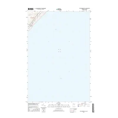
2016 Map of Two Harbors OE S
USGS Topo · Published 2016About this map
Larsmont occupies a small, elevated wedge of the North Shore, where the land meets the expansive waters of Lake Superior. This 2016 survey shows the community’s layout at the edge of the lake, defined by the transition from traditional routes like Old Hwy 61 and Co Rd 101 to local residential paths such as Isackson Rd and Braemar Ln. Most of the area is dominated by the open water of the Great Lake, with the shoreline landscape characterized by steep contours that rise quickly away from the water’s edge. The transportation network here is anchored by the lakefront, featuring Scenic Dr and Larsmont Rd, which follow the natural topography of the rugged Minnesota coast.
Find a feature on this map
9 named features on this map. Tap any name to fly to it.
Don’t see what you’re looking for? This feature index may not catch every label — zoom into the map to look around manually.
Map Details
Editions of this 2016 Two Harbors OE S Map
This is the sole edition of this map. No revisions or reprints were ever made.
Other maps of this area

1953 · Knife River
USGS Topo · 1:24,000

1953 · Ashland
USGS Topo · 1:250,000

1954 · Mc Carthy Creek
USGS Topo · 1:24,000

1954 · Two Harbors
USGS Topo · 1:250,000

1957 · Two Harbors
USGS Topo · 1:250,000

1957 · Two Harbors
USGS Topo · 1:62,500

1957 · Two Harbors
USGS Topo · 1:24,000

1957 · Castle Danger
USGS Topo · 1:24,000

1958 · Ashland
USGS Topo · 1:250,000

1958 · Two Harbors
USGS Topo · 1:250,000