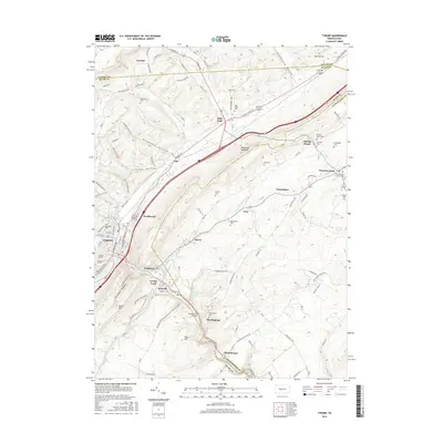
2016 Map of Tyrone
USGS Topo · Published 2016About this map
The Little Juniata River and Bald Eagle Creek meet south of the industrial hub at Tyrone, defining a landscape where valley corridors dictated the path of historical growth. This 2016 survey documents the dense residential and civic core of Tyrone, including landmarks like Gray Memorial Field and Eastlawn Cem, while tracing the dispersal of smaller rural communities throughout the surrounding hollows. Settlements like Tyrone Forge, Ironville, and Birmingham are mapped alongside the complex topography of Bald Eagle Mountain and Brush Mtn. Genealogists will find numerous family-named landmarks and rural burial grounds, such as the Branstetter Cem and Grazier Cem, while the industrial legacy of the region is evident in the rail infrastructure at Van Scoyoc Siding and the road networks through Baughman Hollow.
Find a feature on this map
96 named features on this map. Tap any name to fly to it.
Don’t see what you’re looking for? This feature index may not catch every label — zoom into the map to look around manually.
Map Details
Editions of this 2016 Tyrone Map
This is the sole edition of this map. No revisions or reprints were ever made.
Other maps of this area

1903 · Houtzdale
USGS Topo · 1:62,500

1905 · Houtzdale
USGS Topo · 1:62,500

1920 · Altoona
USGS Topo · 1:62,500

1922 · Philipsburg
USGS Topo · 1:62,500

1922 · Altoona
USGS Topo · 1:62,500

1923 · Tyrone
USGS Topo · 1:62,500

1929 · Tyrone
USGS Topo · 1:48,000

1933 · Tyrone
USGS Topo · 1:62,500

1939 · Philipsburg
USGS Topo · 1:62,500

1944 · Houtzdale
USGS Topo · 1:24,000
Featured Places
- Tyrone, PA
- Warriors Mark Township, PA
- Spruce Creek Township, PA
- Birmingham, PA
- Spring Mount, Warriors Mark Township