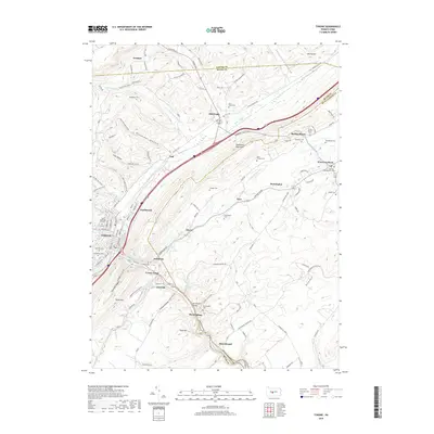
2019 Map of Tyrone
USGS Topo · Published 2019About this map
Tyrone serves as the industrial and social anchor of this Blair County landscape, where the Little Juniata River and Bald Eagle Creek converge. The settlement pattern follows the narrow valley floors, hemmed in by the prominent heights of Bald Eagle Mountain and Brush Mtn. This late-era survey reveals a densely clustered network of smaller communities like Nealmont, Ironville, and Birmingham, many of which developed around early furnace and forge sites. The map is a significant resource for genealogical research, documenting numerous small family and community burial grounds such as the Beck Family Cem, Branstetter Cem, and Nearhoff Cem. Evidence of the region’s transportation history is preserved through labels like Van Scoyoc Siding and the Warriors Mark Path, tracing the movement of goods and people between the mountain ridges.
Find a feature on this map
93 named features on this map. Tap any name to fly to it.
Don’t see what you’re looking for? This feature index may not catch every label — zoom into the map to look around manually.
Map Details
Editions of this 2019 Tyrone Map
This is the sole edition of this map. No revisions or reprints were ever made.
Other maps of this area

1903 · Houtzdale
USGS Topo · 1:62,500

1905 · Houtzdale
USGS Topo · 1:62,500

1920 · Altoona
USGS Topo · 1:62,500

1922 · Philipsburg
USGS Topo · 1:62,500

1922 · Altoona
USGS Topo · 1:62,500

1923 · Tyrone
USGS Topo · 1:62,500

1929 · Tyrone
USGS Topo · 1:48,000

1933 · Tyrone
USGS Topo · 1:62,500

1939 · Philipsburg
USGS Topo · 1:62,500

1944 · Houtzdale
USGS Topo · 1:24,000
Featured Places
- Tyrone, PA
- Warriors Mark Township, PA
- Spruce Creek Township, PA
- Birmingham, PA
- Spring Mount, Warriors Mark Township