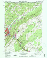
1994 Map of Tyrone
USGS Topo · Published 1997About this map
Tyrone anchors this landscape at the confluence of several mountain hollows, serving as a significant rail hub along the Conrail lines. The industrial and transit character of the region is evident in the complex rail infrastructure, including 3 Tracks and 2 Tracks systems passing through Tyrone Forge and Nealmont. To the southeast, the Little Juniata River snakes through the mountains, flanked by small settlements like Birmingham and Ironville that reflect the area's early industrial and agricultural history.
Find a feature on this map
61 named features on this map. Tap any name to fly to it.
Don’t see what you’re looking for? This feature index may not catch every label — zoom into the map to look around manually.
Map Details
Editions of this 1994 Tyrone Map
This is the sole edition of this map. No revisions or reprints were ever made.
Other maps of this area

1903 · Houtzdale
USGS Topo · 1:62,500

1905 · Houtzdale
USGS Topo · 1:62,500

1920 · Altoona
USGS Topo · 1:62,500

1922 · Philipsburg
USGS Topo · 1:62,500

1922 · Altoona
USGS Topo · 1:62,500

1923 · Tyrone
USGS Topo · 1:62,500

1929 · Tyrone
USGS Topo · 1:48,000

1933 · Tyrone
USGS Topo · 1:62,500

1939 · Philipsburg
USGS Topo · 1:62,500

1944 · Houtzdale
USGS Topo · 1:24,000
Featured Places
- Tyrone, PA
- Warriors Mark Township, PA
- Spruce Creek Township, PA
- Birmingham, PA
- Tyrone Forge, Snyder Township