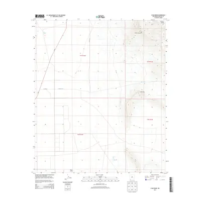
2013 Map of U Bar Ridge
USGS Topo · Published 2013About this map
The Big Hatchet Mountains dominate the eastern landscape of this 2013 survey, where the peaks descend into the arid Playas Valley. This corner of Hidalgo County reveals a history of industrial exploration, most notably evidenced by the Humble Oil and Refining Number 1 site in the southern reaches. The map documents a sparsely populated ranching and mining region where water management is critical, shown through features like Las Cienegas Spring, Big Tank, and Little Tank. Running through the western portion of the quadrangle, NM-81 serves as the primary artery connecting the valley to the surrounding New Mexico desert. The dramatic limestone formations of U Bar Ridge and the steep contours of Thompson Canyon provide clear markers for anyone navigating this high-desert terrain near the international border.
Find a feature on this map
16 named features on this map. Tap any name to fly to it.
Don’t see what you’re looking for? This feature index may not catch every label — zoom into the map to look around manually.
Map Details
Editions of this 2013 U Bar Ridge Map
This is the sole edition of this map. No revisions or reprints were ever made.
Other maps of this area

1917 · Antelope Wells
USGS Topo · 1:62,500

1918 · Big Hatchet Peak
USGS Topo · 1:62,500

1918 · Dog Mountains
USGS Topo · 1:62,500

1918 · Walnut Wells
USGS Topo · 1:62,500

1919 · Antelope Wells
USGS Topo · 1:62,500

1923 · Walnut Wells
USGS Topo · 1:62,500

1955 · Douglas
USGS Topo · 1:250,000

1959 · Douglas
USGS Topo · 1:250,000

1961 · Douglas
USGS Topo · 1:250,000

1964 · Douglas
USGS Topo · 1:250,000