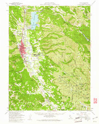
1958 Map of Ukiah
USGS Topo · Published 1961About this map
The Russian River valley serves as the central artery for this late 1950s landscape, where the Northwestern Pacific railroad and U S Hwy 101 parallel the water's course through Ukiah. To the east, the newly formed Mendocino Lake is visible behind its dam, reshaping the drainage of the East Fork and Cold Creek. This era captures the city during a period of institutional significance, featuring the large grounds of the Mendocino State Hospital near Talmage and the Municipal Airport on the valley floor. Tribal lands including the Pinoliville Rancheria and Guidiville Rancheria are clearly demarcated, while the surrounding Mendocino Mountains are dotted with family ranch names like Ruddick Ranch and McNab Ranch. The map also details numerous local institutions, from Vichy Springs to schools like Pomolita Sch and the Nokomis School.
Find a feature on this map
111 named features on this map. Tap any name to fly to it.
Don’t see what you’re looking for? This feature index may not catch every label — zoom into the map to look around manually.
Map Details
Editions of this 1958 Ukiah Map
2 editions found
Other maps of this area

1920 · Ukiah
USGS Topo · 1:62,500

1921 · Kelseyville
USGS Topo · 1:62,500

1922 · Willits
USGS Topo · 1:62,500

1922 · Hullville
USGS Topo · 1:62,500

1938 · Lakeport
USGS Topo · 1:62,500

1938 · Hopland
USGS Topo · 1:62,500

1942 · Willits
USGS Topo · 1:62,500

1943 · Pomo
USGS Topo · 1:62,500

1943 · Boonville
USGS Topo · 1:62,500

1943 · Kelseyville
USGS Topo · 1:62,500