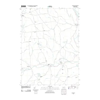
2010 Map of Ulster
USGS Topo · Published 2010About this map
The Susquehanna River carves the eastern edge of this Bradford County landscape, where small agricultural settlements and family burial grounds dot the upland terrain. Rural communities like Luthers Mills and East Smithfield serve as anchors for a network of winding country roads such as Laurel Hill Rd and Old School Rd. The map reveals a high density of small cemeteries, including Union Cemetery, Thomas Cemetery, and the Gustin Cemetery, providing significant points of interest for genealogists tracing early families in Sheshequin Township. Central to the geography are numerous watercourses like Browns Creek and Sugar Creek, while recreational and commemorative sites such as Mountain Lake and Bradford County Memorial Park highlight the area's local social history. The intricate road system, including named paths like Bridge Path, illustrates the long-standing connectivity between crossroads like Saco, Riggs, and Overshot.
Find a feature on this map
89 named features on this map. Tap any name to fly to it.
Don’t see what you’re looking for? This feature index may not catch every label — zoom into the map to look around manually.
Map Details
Editions of this 2010 Ulster Map
This is the sole edition of this map. No revisions or reprints were ever made.
Other maps of this area

1923 · Towanda
USGS Topo · 1:62,500

1926 · Towanda
USGS Topo · 1:62,500

1939 · Sayre
USGS Topo · 1:62,500

1942 · Sayre
USGS Topo · 1:62,500

1943 · Towanda
USGS Topo · 1:62,500

1943 · Monroeton
USGS Topo · 1:62,500

1943 · Powell
USGS Topo · 1:62,500

1945 · Powell
USGS Topo · 1:62,500

1948 · Sayre
USGS Topo · 1:62,500

1954 · Williamsport
USGS Topo · 1:250,000
Featured Places
- Sheshequin Township, PA
- Ulster Township, PA
- North Towanda Township, PA
- West Burlington Township, PA
- Burlington, PA