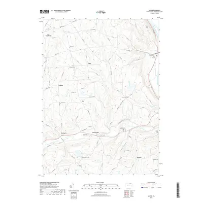
2019 Map of Ulster
USGS Topo · Published 2019About this map
The Susquehanna River flows along the eastern edge of this landscape, defining the Sheshequin Valley near the town of Ulster. The terrain is marked by numerous small settlements and family-named landmarks that speak to the region's agricultural and rural history. Moving west from the river, the elevation rises into a series of hollows and hills, including Toad Hollow and Lynch Hill.
Find a feature on this map
95 named features on this map. Tap any name to fly to it.
Don’t see what you’re looking for? This feature index may not catch every label — zoom into the map to look around manually.
Map Details
Editions of this 2019 Ulster Map
This is the sole edition of this map. No revisions or reprints were ever made.
Other maps of this area

1923 · Towanda
USGS Topo · 1:62,500

1926 · Towanda
USGS Topo · 1:62,500

1939 · Sayre
USGS Topo · 1:62,500

1942 · Sayre
USGS Topo · 1:62,500

1943 · Towanda
USGS Topo · 1:62,500

1943 · Monroeton
USGS Topo · 1:62,500

1943 · Powell
USGS Topo · 1:62,500

1945 · Powell
USGS Topo · 1:62,500

1948 · Sayre
USGS Topo · 1:62,500

1954 · Williamsport
USGS Topo · 1:250,000
Featured Places
- Sheshequin Township, PA
- Ulster Township, PA
- North Towanda Township, PA
- West Burlington Township, PA
- Burlington, PA