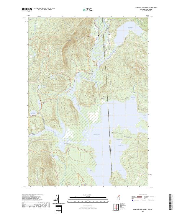
2024 Map of Umbagog Lake North
USGS Topo · Published 2024About this map
Umbagog National Wildlife Refuge dominates this northern frontier, where the Magalloway River winds through vast wetlands and marshes known as Sweat Meadows. The landscape is a complex network of water and timbered ridges, defined by the meeting of the Magalloway and Androscoggin River just north of Umbagog Lake. For genealogists and local historians, the map preserves the locations of the Wentworth Location Cem and the Magalloway Church Cem near the riverbanks.
Find a feature on this map
58 named features on this map. Tap any name to fly to it.
Don’t see what you’re looking for? This feature index may not catch every label — zoom into the map to look around manually.
Map Details
Editions of this 2024 Umbagog Lake North Map
This is the sole edition of this map. No revisions or reprints were ever made.
Other maps of this area

1930 · Milan
USGS Topo · 1:62,500

1930 · Errol
USGS Topo · 1:62,500

1933 · Milan
USGS Topo · 1:62,500

1934 · Errol
USGS Topo · 1:62,500

1934 · Milan
USGS Topo · 1:62,500

1940 · Oquossoc
USGS Topo · 1:62,500

1942 · Oquossoc
USGS Topo · 1:62,500

1943 · Old Speck Mtn
USGS Topo · 1:62,500

1945 · Old Speck Mtn
USGS Topo · 1:62,500

1950 · Lewiston
USGS Topo · 1:250,000