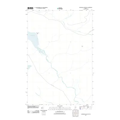
2011 Map of Umsaskis Lake East
USGS Topo · Published 2011About this map
Umsaskis Lake and the winding Allagash River dominate this portion of the Maine North Woods, a landscape defined by its remote waterways and the infrastructure of the logging industry. In this 2011 survey, the presence of the American Realty Depot Camp and Poulins Camp highlights the specialized settlement patterns of the region, where seasonal and industrial encampments serve as the primary human nodes.
Find a feature on this map
11 named features on this map. Tap any name to fly to it.
Don’t see what you’re looking for? This feature index may not catch every label — zoom into the map to look around manually.
Map Details
Editions of this 2011 Umsaskis Lake East Map
This is the sole edition of this map. No revisions or reprints were ever made.
Other maps of this area

1932 · Umsaskis Lake
USGS Topo · 1:48,000

1932 · Musquacook Lakes
USGS Topo · 1:48,000

1935 · Umsaskis Lake
USGS Topo · 1:62,500

1935 · Musquacook Lakes
USGS Topo · 1:62,500

1954 · Spider Lake
USGS Topo · 1:62,500

1954 · Churchill Lake
USGS Topo · 1:62,500

1954 · Presque Isle
USGS Topo · 1:250,000

1958 · Presque Isle
USGS Topo · 1:250,000

1960 · Presque Isle
USGS Topo · 1:250,000

1961 · Spider Lake
USGS Topo · 1:62,500