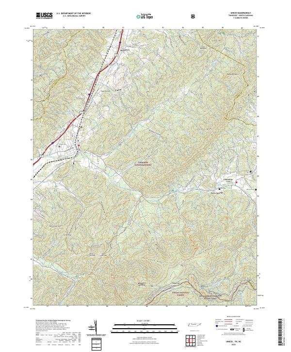
2022 Map of Unicoi
USGS Topo · Published 2022About this map
Marbleton and Unicoi anchor the northern valley where the CSX Transportation rail line follows the winding path of Buffalo Cr. This 2022 survey captures the rugged interface between established mountain settlements and protected wilderness, with the Cherokee National Forest and Pisgah National Forest covering the high ridges. Steep terrain is defined by prominent landmarks like Bear Trail Ridge and Rattlesnake Ridge, while the Appalachian National Scenic Trail traverses the southern peaks through Low Gap. For local history, the map preserves the locations of numerous family-named cemeteries, including Swingle Cem and Peterson Cem, situated along the lower slopes and hollows. Farther east, the community of Limestone Cove sits near the base of Stone Mtn, marking a landscape where narrow valleys like Sugar Hollow have long dictated the movement of residents and roads.
Find a feature on this map
127 named features on this map. Tap any name to fly to it.
Don’t see what you’re looking for? This feature index may not catch every label — zoom into the map to look around manually.
Map Details
Editions of this 2022 Unicoi Map
This is the sole edition of this map. No revisions or reprints were ever made.
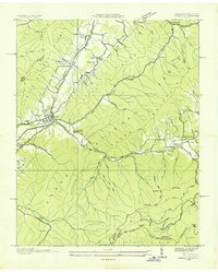
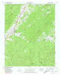
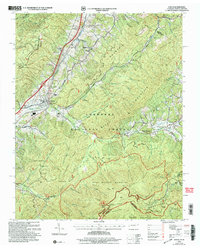
Historical Maps of Davis Springs Through Time
4 maps found