1997 Map of Unikappi
USGS Topo · Published 2003About this map
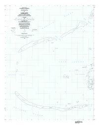
Chuuk Lagoon dominates this survey, showcasing the complex coral reef structures and islands of the Faichuk group during the late twentieth century. The map details the islands of Pata and Polle, where small settlements such as Unikappi, Pukuan, and Wichap are connected by a network of trails. This era of Micronesian geography is marked by the transition of the region to the Federated States of Micronesia, with the interior of these islands featuring numerous schools and cemeteries near the coastal fringes. The maritime landscape is defined by extensive reefs like Ochonap and Fanufon, which enclose protected waters and smaller islets such as Onamue and Onanei. The placement of School and Cemetery symbols indicates the centers of local community life on these western islands of the lagoon.
Find a feature on this map
73 named features on this map. Tap any name to fly to it.
Don’t see what you’re looking for? This feature index may not catch every label — zoom into the map to look around manually.
Map Details
Editions of this 1997 Unikappi Map
This is the sole edition of this map. No revisions or reprints were ever made.