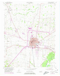
1954 Map of Union City
USGS Topo · Published 1980About this map
Union City serves as a major hub of activity in this Obion County landscape, defined by its role as a rail crossroads where the Illinois Central Gulf and Louisville And Nashville lines intersect. The city center is densely marked with civic importance, including the Courthouse, Armory, and County Hospital, while residential expansion is evident in neighborhoods like Pleasant Valley. Beyond the city limits, the terrain transitions into a mosaic of small farming communities and family-named landmarks such as Woodland Mills and McDowell Chapel.
Find a feature on this map
36 named features on this map. Tap any name to fly to it.
Don’t see what you’re looking for? This feature index may not catch every label — zoom into the map to look around manually.
Map Details
Editions of this 1954 Union City Map
2 editions found
Other maps of this area

1939 · Hickman
USGS Topo · 1:62,500

1950 · Obion
USGS Topo · 1:24,000

1950 · Rives
USGS Topo · 1:24,000

1951 · Obion
USGS Topo · 1:24,000

1951 · Rives
USGS Topo · 1:24,000

1951 · Cayce
USGS Topo · 1:24,000

1951 · Hickman
USGS Topo · 1:24,000

1952 · Crutchfield
USGS Topo · 1:24,000

1952 · Water Valley
USGS Topo · 1:62,500

1954 · Union City
USGS Topo · 1:24,000