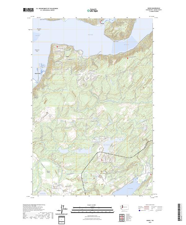
2023 Map of Union
USGS Topo · Published 2023About this map
The dramatic shoreline of The Great Bend anchors this contemporary topographic view of the southern reach of Hood Canal. This maritime landscape is defined by the proximity of the Skokomish Flats and Annas Bay to the rising terrain of Webb Hill. The settlement of Union remains a focal point, where researchers will find the Union Pioneer Cem positioned near the water's edge. South of the canal, a dense network of residential developments and recreational waters has emerged, including Lake Limerick and Lake Leprechaun. These modern water bodies contrast with the older natural features like Schumacher Creek and McEwen Prairie, illustrating how contemporary land use has integrated with the area's glacial geography. From the north shore at Tahuya to the southern waters of Oakland Bay, the map traces the intersection of Puget Sound tidewaters and upland forestry.
Find a feature on this map
100 named features on this map. Tap any name to fly to it.
Don’t see what you’re looking for? This feature index may not catch every label — zoom into the map to look around manually.
Map Details
Editions of this 2023 Union Map
This is the sole edition of this map. No revisions or reprints were ever made.
Other maps of this area

1937 · Olympia
USGS Topo · 1:62,500

1938 · Allyn
USGS Topo · 1:62,500

1939 · Shelton
USGS Topo · 1:62,500

1943 · Potlatch
USGS Topo · 1:62,500

1949 · Olympia
USGS Topo · 1:62,500

1952 · Potlatch
USGS Topo · 1:62,500

1953 · Lake Wooten
USGS Topo · 1:24,000
1953 · Mason Lake
USGS Topo · 1:24,000

1953 · Shelton
USGS Topo · 1:62,500

1958 · Seattle
USGS Topo · 1:250,000