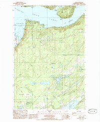
1985 Map of Union
USGS Topo · Published 1985About this map
Hood Canal dominates this mid-1980s landscape, where its waters make a dramatic turn at The Great Bend near the Skokomish Indian Reservation. The map captures the coastal community of Union and the inland settlement of Tahuya, joined by a network of local thoroughfares like Dalby Road and Mason Lake Road. Moving south from the tidal reaches of Skokomish Flats, the terrain rises into a series of freshwater bodies, including Lake Limerick, Cranberry Lake, and Rex Lake. This area shows a mix of recreational and residential development, evidenced by the Trolley Park area and multiple boat ramps along the lakeshores. The southern reaches are characterized by the open Mc Ewen Prairie and industrial markers such as several Borrow Pits and Gravel Pit sites, suggesting the ongoing use of local resources for infrastructure alongside the timbered hills of the Olympic Peninsula foothills.
Find a feature on this map
48 named features on this map. Tap any name to fly to it.
Don’t see what you’re looking for? This feature index may not catch every label — zoom into the map to look around manually.
Map Details
Editions of this 1985 Union Map
This is the sole edition of this map. No revisions or reprints were ever made.
Other maps of this area

1937 · Olympia
USGS Topo · 1:62,500

1938 · Allyn
USGS Topo · 1:62,500

1939 · Shelton
USGS Topo · 1:62,500

1943 · Potlatch
USGS Topo · 1:62,500

1949 · Olympia
USGS Topo · 1:62,500

1952 · Potlatch
USGS Topo · 1:62,500

1953 · Lake Wooten
USGS Topo · 1:24,000
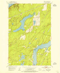
1953 · Mason Lake
USGS Topo · 1:24,000

1953 · Shelton
USGS Topo · 1:62,500

1958 · Seattle
USGS Topo · 1:250,000