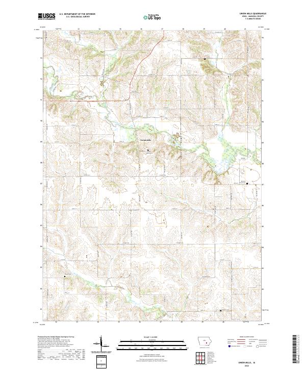
2022 Map of Union Mills
USGS Topo · Published 2022About this map
Union Mills serves as a central landmark in this agricultural landscape of Mahaska County, Iowa. The winding course of the North Skunk River carves through the terrain, joined by tributaries such as Buck Cr and Moon Cr. This 2022 survey documents a rural environment where land use is dictated by the river valleys and an extensive grid of local roads, including Merino Ave and Snyder Ave. Genealogists and local historians will find significant value in the distribution of burial grounds throughout the area, such as the Union Mills Cem, the remote Mormon Point Cem, and the Tilford Cem located in the northern reaches. In the southern portion of the quadrangle, Middle Cr flows past Woods Cem, reflecting the persistent placement of historical community sites along these essential watercourses.
Find a feature on this map
49 named features on this map. Tap any name to fly to it.
Don’t see what you’re looking for? This feature index may not catch every label — zoom into the map to look around manually.
Map Details
Editions of this 2022 Union Mills Map
This is the sole edition of this map. No revisions or reprints were ever made.
Other maps of this area

1954 · Des Moines
USGS Topo · 1:250,000

1956 · Des Moines
USGS Topo · 1:250,000

1957 · Des Moines
USGS Topo · 1:250,000

1965 · Gibson
USGS Topo · 1:24,000

1965 · Rose Hill
USGS Topo · 1:24,000

1968 · University Park
USGS Topo · 1:24,000

1968 · Barnes City
USGS Topo · 1:24,000

1968 · Oskaloosa
USGS Topo · 1:24,000

1969 · Des Moines
USGS Topo · 1:250,000

1979 · Montezuma
USGS Topo · 1:24,000