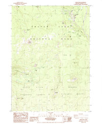
1985 Map of Union Peak
USGS Topo · Published 1985About this map
Crater Lake National Park occupies the northern half of this 1985 survey, where the Pacific Crest National Scenic Trail traverses a landscape defined by volcanic geology and dense forest. The map documents the recreational infrastructure of the mid-1980s, including the Mazama Campground, the Lodgepole Picnic Area, and an Entrance Sta. These facilities serve as basepoints for exploring notable natural features like Godfrey Glen and the dramatic Duwee Falls.
Find a feature on this map
38 named features on this map. Tap any name to fly to it.
Don’t see what you’re looking for? This feature index may not catch every label — zoom into the map to look around manually.
Map Details
Editions of this 1985 Union Peak Map
This is the sole edition of this map. No revisions or reprints were ever made.
Other maps of this area

1891 · Ashland
USGS Topo · 1:250,000

1893 · Ashland
USGS Topo · 1:250,000

1897 · Ashland
USGS Topo · 1:250,000

1955 · Rustler Peak
USGS Topo · 1:62,500

1955 · Pelican Butte
USGS Topo · 1:62,500

1955 · Medford
USGS Topo · 1:250,000

1956 · Prospect
USGS Topo · 1:62,500

1957 · Medford
USGS Topo · 1:250,000

1958 · Medford
USGS Topo · 1:250,000
1975 · Prospect 1 NW
USGS Topo · 1:24,000