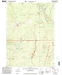
1998 Map of Union Peak
USGS Topo · Published 2000About this map
Crater Lake National Park occupies the northern half of this landscape, characterized by dramatic geologic features and high-elevation watersheds. The prominent volcanic spire of Union Peak serves as a central landmark, standing above the Pumice Flat and the surrounding timberlands of the Rogue River National Forest and Winema National Forest. This late-1990s revision details the established recreational infrastructure of the era, including the Mazama Campground and the Lodgepole Picnic Area.
Find a feature on this map
59 named features on this map. Tap any name to fly to it.
Don’t see what you’re looking for? This feature index may not catch every label — zoom into the map to look around manually.
Map Details
Editions of this 1998 Union Peak Map
This is the sole edition of this map. No revisions or reprints were ever made.
Other maps of this area

1891 · Ashland
USGS Topo · 1:250,000

1893 · Ashland
USGS Topo · 1:250,000

1897 · Ashland
USGS Topo · 1:250,000

1955 · Rustler Peak
USGS Topo · 1:62,500

1955 · Pelican Butte
USGS Topo · 1:62,500

1955 · Medford
USGS Topo · 1:250,000

1956 · Prospect
USGS Topo · 1:62,500

1957 · Medford
USGS Topo · 1:250,000

1958 · Medford
USGS Topo · 1:250,000
1975 · Prospect 1 NW
USGS Topo · 1:24,000