
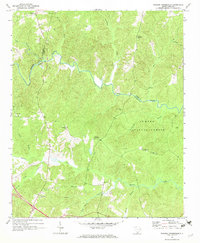
1969 Map of Union West
USGS Topo · Published 1973About this map
The Union city limits and the neighboring industrial settlement of Buffalo anchor this topographic study, where the Piedmont landscape is defined by the sweeping course of the Tyger River. This late-1960s perspective captures a community in balance between its urban development and the vast wooded tracts of the Sumter National Forest. The local geography is etched by numerous watercourses, including Fairforest Creek and Buffalo Creek, which historically dictated the placement of roads and early mills. Social life and genealogy are well-represented through institutions like the Union Academy, Ricey Chapel, and the Padgetts Creek Cem. The arrival of the Southern railroad line and the presence of the County Fairgrounds further indicate the town’s role as a regional hub for trade and community gathering during this era.
Find a feature on this map
52 named features on this map. Tap any name to fly to it.
Don’t see what you’re looking for? This feature index may not catch every label — zoom into the map to look around manually.
Map Details
Editions of this 1969 Union West Map
This is the sole edition of this map. No revisions or reprints were ever made.
Other maps of this area

1941 · Spartanburg
USGS Topo · 1:250,000

1947 · Spartanburg
USGS Topo · 1:62,500

1949 · Spartanburg
USGS Topo · 1:62,500

1953 · Spartanburg
USGS Topo · 1:250,000

1960 · Spartanburg
USGS Topo · 1:250,000

1963 · Spartanburg
USGS Topo · 1:250,000

1964 · Spartanburg
USGS Topo · 1:250,000

1969 · Cross Anchor
USGS Topo · 1:24,000

1969 · Sedalia
USGS Topo · 1:24,000
1969 · Philson Crossroads
USGS Topo · 1:24,000