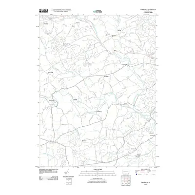
2010 Map of Unionville
USGS Topo · Published 2010About this map
Brandywine Creek and its complex network of branches dominate this Chester County landscape, where the East Branch and West Branch converge near the center of the survey. The terrain is defined by historic water-powered industry and community nodes, evidenced by the Saverys Mill and Saverys Mill Dam on Bennetts Run, alongside the Embreeville Dam. Settlement patterns follow the winding creek valleys and ridges, connecting crossroads like Marshallton, Unionville, and Northbrook. Transportation infrastructure includes the northern corridor of the P C Railroad near Thorndale. Cultural landmarks such as Saint Joseph Cemetery and the Philadelphia YMCA Camp suggest a long-established community structure within this rural-suburban patchwork. The presence of named hills like Harmony Hill and numerous small runs reveals a landscape that has retained its colonial-era topographical character well into the modern era.
Find a feature on this map
109 named features on this map. Tap any name to fly to it.
Don’t see what you’re looking for? This feature index may not catch every label — zoom into the map to look around manually.
Map Details
Editions of this 2010 Unionville Map
This is the sole edition of this map. No revisions or reprints were ever made.
Other maps of this area

1901 · West Chester
USGS Topo · 1:62,500

1904 · West Chester
USGS Topo · 1:62,500

1904 · Coatesville
USGS Topo · 1:62,500

1905 · Honey Brook
USGS Topo · 1:62,500

1906 · Phoenixville
USGS Topo · 1:62,500

1906 · Coatesville
USGS Topo · 1:62,500

1907 · Honeybrook
USGS Topo · 1:62,500

1918 · Coatesville
USGS Topo · 1:62,500

1941 · Honeybrook
USGS Topo · 1:62,500

1943 · Coatesville
USGS Topo · 1:62,500
Featured Places
- West Goshen Township, PA
- Caln Township, PA
- Birmingham Township, PA
- Pocopson Township, PA
- Unionville, East Marlborough Township