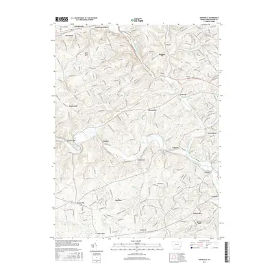
2016 Map of Unionville
USGS Topo · Published 2016About this map
Brandywine Creek and its major tributaries, including the West Branch and East Branch, carve through the rolling hills of central Chester County. This 2016 survey shows a landscape where historic agrarian roots meet modern residential patterns, centered on the historic crossroads of Marshallton and Unionville. The map captures the dense network of early local thoroughfares like Ground Hog College Rd and Lenape Unionville Rd that connect dozens of small, enduring hamlets. Genealogists can trace family footprints through sites like Saint Joseph Cem and Saverys Mill, or locate residential clusters in Embreeville, Pocopson, and Lenape. The topography of the South Valley Hills and Harmony Hill remains a defining physical characteristic, framing the valleys where community life has centered for centuries.
Find a feature on this map
45 named features on this map. Tap any name to fly to it.
Don’t see what you’re looking for? This feature index may not catch every label — zoom into the map to look around manually.
Map Details
Editions of this 2016 Unionville Map
This is the sole edition of this map. No revisions or reprints were ever made.
Other maps of this area

1901 · West Chester
USGS Topo · 1:62,500

1904 · West Chester
USGS Topo · 1:62,500

1904 · Coatesville
USGS Topo · 1:62,500

1905 · Honey Brook
USGS Topo · 1:62,500

1906 · Phoenixville
USGS Topo · 1:62,500

1906 · Coatesville
USGS Topo · 1:62,500

1907 · Honeybrook
USGS Topo · 1:62,500

1918 · Coatesville
USGS Topo · 1:62,500

1941 · Honeybrook
USGS Topo · 1:62,500

1943 · Coatesville
USGS Topo · 1:62,500
Featured Places
- West Goshen Township, PA
- Caln Township, PA
- Birmingham Township, PA
- Pocopson Township, PA
- Unionville, East Marlborough Township