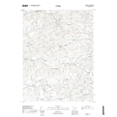
2019 Map of Unionville
USGS Topo · Published 2019About this map
The East Branch Brandywine Creek and its western counterpart carve through the heart of this Chester County landscape, defining the character of several long-established hamlets. Centered on Marshallton, the map reveals a dense concentration of Quaker heritage and early religious sites, including the Bradford Friends Burial Ground and the Romansville Friends Burying Ground. To the north, the terrain transitions into the distinct Chester Valley near Gallagherville, while the southern reaches follow the Pocopson Cr toward Parkersville. This 2019 survey documents a region where colonial-era foundations remain visible alongside modern development, tracing a lineage of faith and community through landmarks like the Ebenezer African Methodist Episcopal Cem and the Parkersville Friends Meeting Cem. The presence of Saverys Mill and numerous family-named burial sites offers a clear look at the enduring agrarian and industrial patterns that shaped this portion of Pennsylvania.
Find a feature on this map
268 named features on this map. Tap any name to fly to it.
Don’t see what you’re looking for? This feature index may not catch every label — zoom into the map to look around manually.
Map Details
Editions of this 2019 Unionville Map
This is the sole edition of this map. No revisions or reprints were ever made.
Other maps of this area

1901 · West Chester
USGS Topo · 1:62,500

1904 · West Chester
USGS Topo · 1:62,500

1904 · Coatesville
USGS Topo · 1:62,500

1905 · Honey Brook
USGS Topo · 1:62,500

1906 · Phoenixville
USGS Topo · 1:62,500

1906 · Coatesville
USGS Topo · 1:62,500

1907 · Honeybrook
USGS Topo · 1:62,500

1918 · Coatesville
USGS Topo · 1:62,500

1941 · Honeybrook
USGS Topo · 1:62,500

1943 · Coatesville
USGS Topo · 1:62,500
Featured Places
- West Goshen Township, PA
- Caln Township, PA
- Birmingham Township, PA
- Pocopson Township, PA
- Unionville, East Marlborough Township