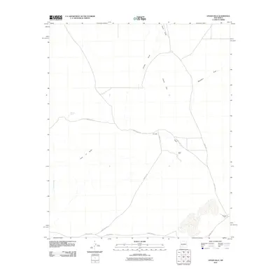
2010 Map of Upham Hills
USGS Topo · Published 2010About this map
Rawls Farm and Flat Lake Ranch stand as primary landmarks in this arid stretch of the Chihuahuan Desert north of the Las Cruces area. The landscape is defined by its drainage patterns and subtle relief, where the ephemeral waters of Jornada Draw, Lyons Draw, and Blackshire Draw converge toward the larger Rincon Arroyo. The prominence of Point of Rocks and the namesake Upham Hills provide essential navigation points across the open range.
Find a feature on this map
15 named features on this map. Tap any name to fly to it.
Don’t see what you’re looking for? This feature index may not catch every label — zoom into the map to look around manually.
Map Details
Editions of this 2010 Upham Hills Map
This is the sole edition of this map. No revisions or reprints were ever made.
Other maps of this area
1916 · Tonuco
USGS Topo · 1:125,000
1932 · Tonuco
USGS Topo · 1:125,000
1948 · Chicken Well
USGS Topo · 1:62,500
1948 · San Diego Mountain
USGS Topo · 1:62,500
1955 · Las Cruces
USGS Topo · 1:250,000
1958 · Las Cruces
USGS Topo · 1:250,000
1959 · Rincon
USGS Topo · 1:24,000
1959 · Upham
USGS Topo · 1:62,500
1981 · Gilmore Draw
USGS Topo · 1:24,000
1981 · Prisor Hill
USGS Topo · 1:24,000