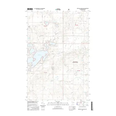
2015 Map of Upper Eau Claire Lake
USGS Topo · Published 2015About this map
Chequamegon National Forest encompasses the eastern half of this terrain, where the northern Wisconsin woods are defined by an intricate network of glacial kettle lakes and springs. Centered around Upper Eau Claire Lake, the landscape is a mosaic of water bodies including Robinson Lake, Sweet Lake, and the smaller Mountain Lake to the northeast. This area, managed under the forest service's jurisdiction, is traversed by an extensive system of forest roads and local routes like Co Hwy N and Co Hwy A, indicating its role as a recreational and timber resource. Grounded in the hydrology of the region, the map traces the Ounce River and Mulligan Creek as they flow through the timberland. Notable local water sources like Shunenberg Springs, Hyatt Spring, and Bearsdale Springs point to the subterranean richness of the glacial till, while the Eau Claire Lakes Airport serves as a remote aviation link for this lake-dotted corridor of Bayfield County.
Find a feature on this map
75 named features on this map. Tap any name to fly to it.
Don’t see what you’re looking for? This feature index may not catch every label — zoom into the map to look around manually.
Map Details
Editions of this 2015 Upper Eau Claire Lake Map
This is the sole edition of this map. No revisions or reprints were ever made.
Other maps of this area

1944 · Drummond
USGS Topo · 1:48,000

1944 · Hayward
USGS Topo · 1:48,000

1945 · Highland
USGS Topo · 1:48,000

1947 · Drummond
USGS Topo · 1:48,000

1947 · Chittamo
USGS Topo · 1:48,000

1949 · Chittamo
USGS Topo · 1:48,000

1949 · Highland
USGS Topo · 1:48,000

1953 · Ashland
USGS Topo · 1:250,000

1958 · Ashland
USGS Topo · 1:250,000
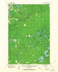
1961 · Ellison Lake
USGS Topo · 1:62,500