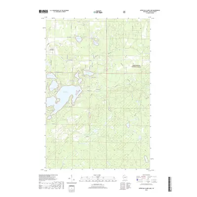
2018 Map of Upper Eau Claire Lake
USGS Topo · Published 2018About this map
Upper Eau Claire Lake serves as the focal point of this recreational and forest landscape in Bayfield County. The map details a complex network of glacial water bodies, including Robinson Lake, Birch Lake, and the smaller Connor Lake, nestled within the sprawling boundaries of the Chequamegon National Forest. The presence of the Eau Claire Lakes Airport near the western edge signifies the area's development as a Northwoods destination. Numerous springs, such as Bearsdale Springs and Shunenberg Springs, feed into the local hydrology, including Tars Cr and the Ounce River. The land is crisscrossed by a mix of established routes like Co Hwy N and more specialized paths like Rifle Range Rd and Kickapoo Trl, reflecting the region's managed forestry and seasonal residency.
Find a feature on this map
57 named features on this map. Tap any name to fly to it.
Don’t see what you’re looking for? This feature index may not catch every label — zoom into the map to look around manually.
Map Details
Editions of this 2018 Upper Eau Claire Lake Map
This is the sole edition of this map. No revisions or reprints were ever made.
Other maps of this area

1944 · Drummond
USGS Topo · 1:48,000

1944 · Hayward
USGS Topo · 1:48,000

1945 · Highland
USGS Topo · 1:48,000

1947 · Drummond
USGS Topo · 1:48,000

1947 · Chittamo
USGS Topo · 1:48,000

1949 · Chittamo
USGS Topo · 1:48,000

1949 · Highland
USGS Topo · 1:48,000

1953 · Ashland
USGS Topo · 1:250,000

1958 · Ashland
USGS Topo · 1:250,000
1961 · Ellison Lake
USGS Topo · 1:62,500