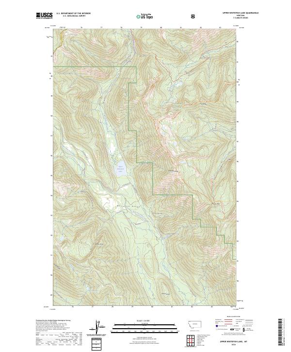
2024 Map of Upper Whitefish Lake
USGS Topo · Published 2024About this map
Upper Whitefish Lake sits at the heart of this high-elevation terrain within the Flathead National Forest, where the complex topography of the Whitefish Range is defined by sharp ridges and deep creek drainages. The landscape is a network of named heights, including Diamond Peak, Antice Point, and the prominent Coal Ridge, which divides the northern watersheds. The drainage system is particularly intricate, with the West Fork and East Fork Swift Creek converging as they flow south toward the Antice Knob area.
Find a feature on this map
42 named features on this map. Tap any name to fly to it.
Don’t see what you’re looking for? This feature index may not catch every label — zoom into the map to look around manually.
Map Details
Editions of this 2024 Upper Whitefish Lake Map
This is the sole edition of this map. No revisions or reprints were ever made.
Other maps of this area

1906 · Kintla Lakes
USGS Topo · 1:125,000

1913 · Stryker
USGS Topo · 1:125,000

1916 · Stryker
USGS Topo · 1:125,000

1938 · Kintla Lakes
USGS Topo · 1:125,000

1957 · Kalispell
USGS Topo · 1:250,000

1960 · Kalispell
USGS Topo · 1:250,000

1961 · Kalispell
USGS Topo · 1:250,000
1966 · Radnor
USGS Topo · 1:24,000

1966 · Red Meadow Lake
USGS Topo · 1:24,000
1966 · Bull Lake
USGS Topo · 1:24,000