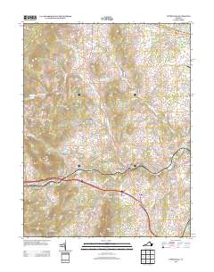
2013 Map of Upperville
USGS Topo · Published 2013About this map
Stribling Orchard and the historic crossroads of Upperville define this Piedmont landscape, where the Blue Ridge foothills meet the agricultural heart of Fauquier County. The map details a complex network of rural settlements and family estates connected by historic thoroughfares like the John S Mosby Hwy and John Marshall Hwy. Between the elevations of Orchard Hill Mountain and Lost Mountain, several distinct communities are documented, including Delaplane, Scuffleburg, and Jacksontown.
Find a feature on this map
75 named features on this map. Tap any name to fly to it.
Don’t see what you’re looking for? This feature index may not catch every label — zoom into the map to look around manually.
Map Details
Editions of this 2013 Upperville Map
This is the sole edition of this map. No revisions or reprints were ever made.
Other maps of this area

1884 · Harpers Ferry
USGS Topo · 1:125,000

1891 · Harpers Ferry
USGS Topo · 1:125,000

1893 · Luray
USGS Topo · 1:125,000

1893 · Harpers Ferry
USGS Topo · 1:125,000

1894 · Warrenton
USGS Topo · 1:125,000

1894 · Winchester
USGS Topo · 1:125,000

1905 · Luray
USGS Topo · 1:125,000

1916 · Berryville
USGS Topo · 1:62,500

1938 · Winchester
USGS Topo · 1:48,000

1939 · Front Royal
USGS Topo · 1:48,000