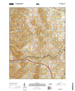
2019 Map of Upperville
USGS Topo · Published 2019About this map
Upperville and Delaplane anchor this portion of northern Virginia, where the Piedmont begins its ascent toward the Blue Ridge Mountains. The landscape is defined by its transition from agricultural valley floors to the high, wooded slopes of Sassafras Rdg, with the Appalachian National Scenic Trail skirting the western edge of the quadrangle along the border of Clarke and Fauquier Counties. Local history is deeply embedded in the rural crossroads and naming conventions, from the small community at Scuffleburg to the various farm-adjacent water bodies like Fleetwood Farm Pond Number One. The map details a well-established network of country lanes such as Rokeby Rd and Blue Banner Rd, alongside significant local burial grounds including Cool Spring Cem and Emmanuel Cem. Notable water features like Goose Cr and Thompson Lake suggest the drainage patterns that have shaped the region's long-standing horse country and farming traditions.
Find a feature on this map
77 named features on this map. Tap any name to fly to it.
Don’t see what you’re looking for? This feature index may not catch every label — zoom into the map to look around manually.
Map Details
Editions of this 2019 Upperville Map
This is the sole edition of this map. No revisions or reprints were ever made.
Other maps of this area

1884 · Harpers Ferry
USGS Topo · 1:125,000

1891 · Harpers Ferry
USGS Topo · 1:125,000

1893 · Luray
USGS Topo · 1:125,000

1893 · Harpers Ferry
USGS Topo · 1:125,000

1894 · Warrenton
USGS Topo · 1:125,000

1894 · Winchester
USGS Topo · 1:125,000

1905 · Luray
USGS Topo · 1:125,000

1916 · Berryville
USGS Topo · 1:62,500

1938 · Winchester
USGS Topo · 1:48,000

1939 · Front Royal
USGS Topo · 1:48,000