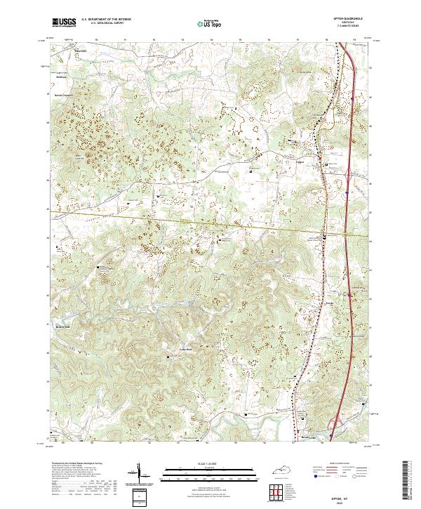
2022 Map of Upton
USGS Topo · Published 2022About this map
Upton serves as a primary hub where the borders of Hardin, Hart, and LaRue counties meet, illustrating a landscape defined by small rural settlements and an extensive network of family-named cemeteries. This modern survey reveals a region characterized by deep hollows and prominent knobs, such as Jacobs Knob and Gardner Knob, which overlook the winding course of Bacon Cr. The map preserves the locations of local landmarks like Riders Mill and the settlement of Lone Star, offering a clear view of how early homesteads were situated relative to water sources like Blue Hole Spring and Round Stone Spring.
Find a feature on this map
104 named features on this map. Tap any name to fly to it.
Don’t see what you’re looking for? This feature index may not catch every label — zoom into the map to look around manually.
Map Details
Editions of this 2022 Upton Map
This is the sole edition of this map. No revisions or reprints were ever made.
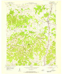
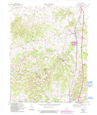
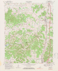
Historical Maps of Melrose Through Time
4 maps found