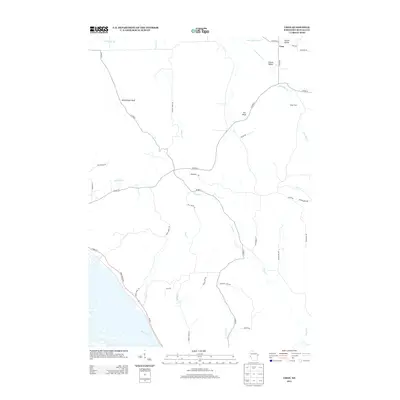
2013 Map of Urne
USGS Topo · Published 2013About this map
Urne and its surrounding Buffalo County landscape are defined by a complex network of coulees and bluffs typical of Wisconsin's driftless region. The settlement at Urne sits at the convergence of several rural routes including Co HWY-F and Co HWY-K, while the wider area is carved by watercourses like Little Bear Cr and the uniquely named By Golly Cr. Notable terrain features such as Rattlesnake Bluff and Fox Bluff rise above the valleys, where local family sites like Klopp Farm appear alongside geographically descriptive names like Larson Valley and Church Valley. In the southwestern corner, the terrain drops toward the Mississippi floodplain, where Wi-35 follows the Great River Rd near the mouth of Deer Creek. The map documents a rural economy structured by the winding paths of Trout Cr and Center Cr, where the roads often follow the narrow valley floors.
Find a feature on this map
42 named features on this map. Tap any name to fly to it.
Don’t see what you’re looking for? This feature index may not catch every label — zoom into the map to look around manually.
Map Details
Editions of this 2013 Urne Map
This is the sole edition of this map. No revisions or reprints were ever made.
Other maps of this area

1929 · Durand
USGS Topo · 1:62,500

1932 · Wabasha
USGS Topo · 1:62,500

1932 · Durand
USGS Topo · 1:62,500

1932 · Alma
USGS Topo · 1:62,500

1935 · Arkansaw
USGS Topo · 1:48,000

1941 · Arkansaw
USGS Topo · 1:62,500

1942 · Arkansaw
USGS Topo · 1:62,500

1950 · Alma
USGS Topo · 1:62,500

1951 · Wabasha
USGS Topo · 1:62,500

1953 · Saint Paul
USGS Topo · 1:250,000