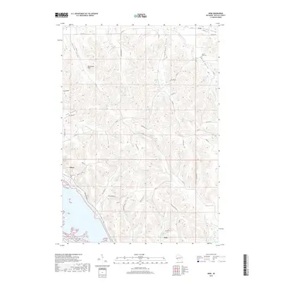
2018 Map of Urne
USGS Topo · Published 2018About this map
Nelson and Alma anchor this survey of Buffalo County, where the topography is defined by the dramatic ascent from the river bottoms to high ridges. The landscape is carved into a series of distinct coulees and valleys, including Fox Coulee, Dry Coulee, and the significant drainage of Larson Valley and Norwegian Valley. These geographic features dictate the winding paths of local roads such as Great River Rd and Deer Creek Rd, which navigate the steep elevations between Rattlesnake Bluff and the wetland margins of Catfish Slough. For local historians, the placement of the Nelson Cem and Church Valley Cem provides clear markers of early community centers. The network of creeks, including Trout Cr and By Golly Cr, illustrates the intricate watershed system feeding into the larger river corridor beyond the bluffs.
Find a feature on this map
46 named features on this map. Tap any name to fly to it.
Don’t see what you’re looking for? This feature index may not catch every label — zoom into the map to look around manually.
Map Details
Editions of this 2018 Urne Map
This is the sole edition of this map. No revisions or reprints were ever made.
Other maps of this area

1929 · Durand
USGS Topo · 1:62,500

1932 · Wabasha
USGS Topo · 1:62,500

1932 · Durand
USGS Topo · 1:62,500

1932 · Alma
USGS Topo · 1:62,500

1935 · Arkansaw
USGS Topo · 1:48,000

1941 · Arkansaw
USGS Topo · 1:62,500

1942 · Arkansaw
USGS Topo · 1:62,500

1950 · Alma
USGS Topo · 1:62,500

1951 · Wabasha
USGS Topo · 1:62,500

1953 · Saint Paul
USGS Topo · 1:250,000