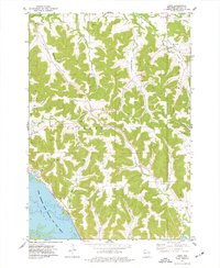
1974 Map of Urne
USGS Topo · Published 1977About this map
Upper Mississippi River Wild Life and Fish Refuge dominates the southwestern corner of this Buffalo County landscape, where the Burlington Northern railroad tracks skirt the riverbanks near Nelson. The terrain is defined by a dense network of coulees and valleys, including Cascade Valley and Norwegian Valley, which channeled early settlement and transportation. These valleys host several small community centers and burial grounds vital for genealogical research, such as Lyster Ch and the Church Valley Cem in Little Church Valley. Significant agricultural and industrial activity is evidenced by numerous quarries and the upland farm tracts marked by fine fence lines. Higher elevations like Rattlesnake Bluff overlook the convergence of Trout Creek and Iron Creek, illustrating the complex drainage patterns that shaped this region's rural development in the mid-1970s.
Find a feature on this map
37 named features on this map. Tap any name to fly to it.
Don’t see what you’re looking for? This feature index may not catch every label — zoom into the map to look around manually.
Map Details
Editions of this 1974 Urne Map
This is the sole edition of this map. No revisions or reprints were ever made.
Other maps of this area

1929 · Durand
USGS Topo · 1:62,500

1932 · Wabasha
USGS Topo · 1:62,500

1932 · Durand
USGS Topo · 1:62,500

1932 · Alma
USGS Topo · 1:62,500

1935 · Arkansaw
USGS Topo · 1:48,000

1941 · Arkansaw
USGS Topo · 1:62,500

1942 · Arkansaw
USGS Topo · 1:62,500

1950 · Alma
USGS Topo · 1:62,500

1951 · Wabasha
USGS Topo · 1:62,500

1953 · Saint Paul
USGS Topo · 1:250,000