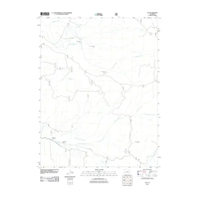
2011 Map of Ute
USGS Topo · Published 2011About this map
Ute serves as the primary landmark in this corner of Montrose County, where the landscape is defined by the drainage networks of Tabeguache Creek and Cottonwood Creek. The map documents a rugged rangeland economy, evident through the distribution of agricultural outposts such as Maupin Cow Camp, Forsman Cow Camp, and Houser Cow Camp. These camps, along with the Glencoe Ditch, highlight the essential infrastructure required to manage livestock and water in the arid Colorado high country. Toward the north, Monument Lake and several springs, including Blue Mud Spring and Ouray Spring, provide critical water sources amidst the surrounding terrain. Notable geographic features like Pine Ridge and the Telephone Draw offer insight into the natural corridors and early communications lines that shaped movement through this territory. The mapping of the Old Highway and 90 RD provides a clear view of the transportation network connecting these remote camps and settlements during the early 21st century.
Find a feature on this map
23 named features on this map. Tap any name to fly to it.
Don’t see what you’re looking for? This feature index may not catch every label — zoom into the map to look around manually.
Map Details
Editions of this 2011 Ute Map
This is the sole edition of this map. No revisions or reprints were ever made.
Other maps of this area
1956 · Moab
USGS Topo · 1:250,000
1959 · Moab
USGS Topo · 1:250,000
1960 · Moab
USGS Topo · 1:250,000
1962 · Moab
USGS Topo · 1:250,000
1964 · Moab
USGS Topo · 1:250,000
1964 · Redvale
USGS Topo · 1:24,000
1964 · Norwood
USGS Topo · 1:24,000
1965 · Moab
USGS Topo · 1:250,000
1967 · Sanborn Park
USGS Topo · 1:24,000
1973 · Ute
USGS Topo · 1:24,000