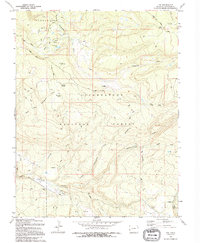
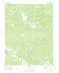
1994 Map of Ute
USGS Topo · Published 1994About this map
Uncompahgre National Forest dominates this high-altitude landscape of western Colorado, where a network of water sources and seasonal camps supported the region's ranching and resource management. The geography is defined by the Tabeguache Basin and the prominent Pine Ridge, with water vital for survival provided by Monument Lake and numerous named seeps like Blue Mud Spring and Ouray Spring. Functional infrastructure is sparse but specific, including the Basin Work Center and the Houser Cow Camp, reflecting the administrative and livestock activities of the mid-to-late 20th century.
Find a feature on this map
37 named features on this map. Tap any name to fly to it.
Don’t see what you’re looking for? This feature index may not catch every label — zoom into the map to look around manually.
Map Details
Editions of this 1994 Ute Map
This is the sole edition of this map. No revisions or reprints were ever made.
Other maps of this area

1956 · Moab
USGS Topo · 1:250,000

1959 · Moab
USGS Topo · 1:250,000

1960 · Moab
USGS Topo · 1:250,000

1962 · Moab
USGS Topo · 1:250,000

1964 · Moab
USGS Topo · 1:250,000
1964 · Redvale
USGS Topo · 1:24,000
1964 · Norwood
USGS Topo · 1:24,000

1965 · Moab
USGS Topo · 1:250,000
1967 · Sanborn Park
USGS Topo · 1:24,000
1973 · Ute
USGS Topo · 1:24,000