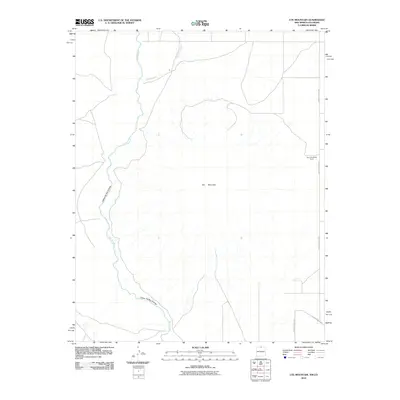
2010 Map of Ute Mountain
USGS Topo · Published 2010About this map
Ute Mountain dominates this high-desert landscape in Taos County, where the volcanic shield rises sharply from the surrounding plateau. The western edge of the map is defined by the deep incision of the Rio Grande, where the river flows through the steep-walled Cañon del Rio Grande. In the northern portion of the quadrangle, Costilla Creek meanders toward its confluence with the main river, crossing a network of section lines and gravel paths. Agriculture and limited settlement are concentrated toward the eastern boundary at Top O the World Farms, served by a grid of local thoroughfares including County Road B-050. This 2010 survey illustrates the intersection of natural volcanic landmarks and the traditional rural road systems of northern New Mexico.
Find a feature on this map
8 named features on this map. Tap any name to fly to it.
Don’t see what you’re looking for? This feature index may not catch every label — zoom into the map to look around manually.
Map Details
Editions of this 2010 Ute Mountain Map
This is the sole edition of this map. No revisions or reprints were ever made.
Other maps of this area

1954 · Raton
USGS Topo · 1:250,000

1954 · Trinidad
USGS Topo · 1:250,000

1955 · Trinidad
USGS Topo · 1:250,000

1958 · Raton
USGS Topo · 1:250,000

1958 · Trinidad
USGS Topo · 1:250,000

1959 · Trinidad
USGS Topo · 1:250,000

1963 · Costilla
USGS Topo · 1:24,000

1963 · Cerro De La Olla
USGS Topo · 1:24,000

1963 · Cerro
USGS Topo · 1:24,000

1963 · Ute Mountain
USGS Topo · 1:24,000