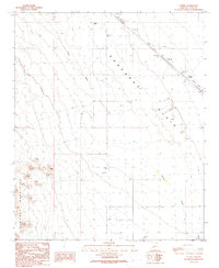
1990 Map of Utting
USGS Topo · Published 1990About this map
Ranegras Plain dominates the central expanse of this 1990 survey, defined by its complex drainage network and desert infrastructure. To the west, the Plomosa Mountains rise sharply, their drainages feeding into Cunningham Wash and Bouse Wash. This landscape is marked by efforts to manage water and travel in an arid environment, featuring numerous Check Dams and a Levee system. Human activity is clustered around the settlement of Utting and isolated outposts such as Haynes Farm and Swadley Well. A Landing Strip and a Substation indicate the modern logistical utility of this corridor, while more secluded markers like a single + Grave and a Drill Hole offer evidence of the area's prospecting and personal history. Numerous 4wd tracks crisscross the terrain, linking remote corrals and wells throughout the quadrangle.
Find a feature on this map
22 named features on this map. Tap any name to fly to it.
Don’t see what you’re looking for? This feature index may not catch every label — zoom into the map to look around manually.
Map Details
Editions of this 1990 Utting Map
This is the sole edition of this map. No revisions or reprints were ever made.
Other maps of this area

1930 · Linskey
USGS Topo · 1:62,500

1942 · Blythe
USGS Topo · 1:250,000

1942 · Vicksburg
USGS Topo · 1:250,000

1954 · Salton Sea
USGS Topo · 1:250,000

1954 · Phoenix
USGS Topo · 1:250,000

1955 · Salton Sea
USGS Topo · 1:250,000

1957 · Phoenix
USGS Topo · 1:250,000

1958 · Phoenix
USGS Topo · 1:250,000

1959 · Salton Sea
USGS Topo · 1:250,000

1960 · Phoenix
USGS Topo · 1:250,000