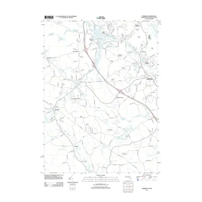
2012 Map of Uxbridge
USGS Topo · Published 2012About this map
The Blackstone River and Mumford River corridors define this industrial landscape of central Massachusetts, where textile heritage is anchored by the Rivulet Mill Complex and the site of Hayward Mill. The settlement pattern follows the water and rail, with Uxbridge and Douglas serving as primary hubs alongside smaller enclaves like North Uxbridge, Linwood, and Plummer Corner. The transit network is shaped by the Providence & Worcester RR and significant local stations such as East Douglas Station. Extensive cemetery data provides a rich resource for family historians, featuring Saint Denis Cem, Evergreen Cem, and the Joseph Richardson Cem. Beyond the mill villages, the terrain transitions into recreational and agricultural spaces, including the Blissful Meadows Golf Course and Douglas Orchard.
Find a feature on this map
220 named features on this map. Tap any name to fly to it.
Don’t see what you’re looking for? This feature index may not catch every label — zoom into the map to look around manually.
Map Details
Editions of this 2012 Uxbridge Map
This is the sole edition of this map. No revisions or reprints were ever made.
Other maps of this area

1886 · Blackstone
USGS Topo · 1:62,500

1889 · Blackstone
USGS Topo · 1:62,500

1889 · Webster
USGS Topo · 1:62,500

1889 · Putnam
USGS Topo · 1:62,500

1889 · Burrillville
USGS Topo · 1:62,500

1892 · Webster
USGS Topo · 1:62,500

1893 · Putnam
USGS Topo · 1:62,500

1893 · Blackstone
USGS Topo · 1:62,500

1894 · Burrillville
USGS Topo · 1:62,500

1900 · Blackstone
USGS Topo · 1:62,500