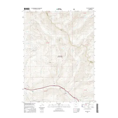
2016 Map of Vail East
USGS Topo · Published 2016About this map
Vail and the settlement of Bighorn anchor the southern edge of this 2016 survey, where the valley floor meets the soaring heights of the Gore Range. This map illustrates the intersection of mountain recreation and modern infrastructure, centering on the Interstate 70 corridor and the Vail Memorial Park. The surrounding landscape is dominated by the White River National Forest, defined by a network of drainage basins like Booth Cr and Pitkin Cr that feed into Gore Cr. High-altitude features such as The Spider, Bald Mtn, and Golden Peak mark the alpine terrain. A significant number of backcountry trails, including the Booth Lake Trail and Bighorn Trail, provide access to remote water bodies like Booth Lake and Pitkin Lake, tracing the routes used by generations of hikers and outdoorsmen through the Eagle and Summit County boundary lands.
Find a feature on this map
41 named features on this map. Tap any name to fly to it.
Don’t see what you’re looking for? This feature index may not catch every label — zoom into the map to look around manually.
Map Details
Editions of this 2016 Vail East Map
This is the sole edition of this map. No revisions or reprints were ever made.
Other maps of this area

1929 · Dillon
USGS Topo · 1:62,500

1933 · Mt. Powell
USGS Topo · 1:48,000

1933 · Ute Peak
USGS Topo · 1:62,500

1934 · Minturn
USGS Topo · 1:62,500

1934 · Dillon
USGS Topo · 1:62,500

1937 · Ute Peak
USGS Topo · 1:62,500

1940 · Mount Powell
USGS Topo · 1:62,500

1950 · Minturn
USGS Topo · 1:62,500

1957 · Leadville
USGS Topo · 1:250,000

1959 · Leadville
USGS Topo · 1:250,000