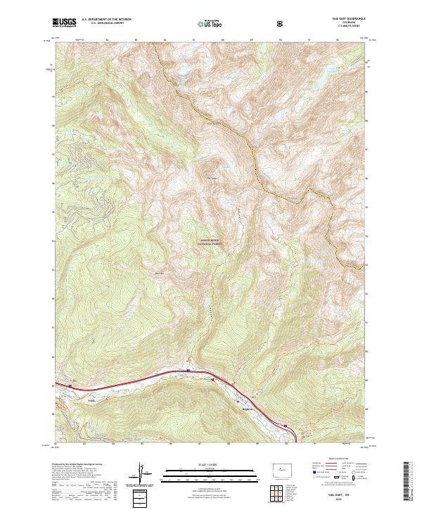
2022 Map of Vail East
USGS Topo · Published 2022About this map
Vail and the nearby community of Bighorn occupy the narrow valley of Gore Cr at the foot of the massive Gore Range. This 2022 survey illustrates the intense concentration of development along the Gore Valley Trl and Big Horn Rd corridor, contrasted against the protected wilderness of the White River National Forest. The map documents a landscape defined by winter sports and high-altitude recreation, featuring named slopes like Golden Peak and a dense network of mountain paths including the Vail Trl and Village Trl. To the north and east, the terrain rises sharply toward alpine features such as The Spider, Bald Mtn, and several high-elevation basins containing Booth Lake and Pitkin Lake. Local landmarks like Vail Memorial Park are also identified within the town's footprint.
Find a feature on this map
44 named features on this map. Tap any name to fly to it.
Don’t see what you’re looking for? This feature index may not catch every label — zoom into the map to look around manually.
Map Details
Editions of this 2022 Vail East Map
This is the sole edition of this map. No revisions or reprints were ever made.
Other maps of this area

1929 · Dillon
USGS Topo · 1:62,500

1933 · Mt. Powell
USGS Topo · 1:48,000

1933 · Ute Peak
USGS Topo · 1:62,500

1934 · Minturn
USGS Topo · 1:62,500

1934 · Dillon
USGS Topo · 1:62,500

1937 · Ute Peak
USGS Topo · 1:62,500

1940 · Mount Powell
USGS Topo · 1:62,500

1950 · Minturn
USGS Topo · 1:62,500

1957 · Leadville
USGS Topo · 1:250,000

1959 · Leadville
USGS Topo · 1:250,000