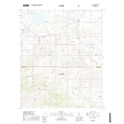
2018 Map of Vail Lake
USGS Topo · Published 2018About this map
Vail Lake and its surrounding valleys dominate this interior portion of Riverside and San Diego counties. The landscape transitions from the open waters and canyons near Butterfield Valley into the high, protected reaches of the Cleveland National Forest. The small settlement of Radec sits within the Radec Valley, serving as a waypoint along a network of canyon roads and truck trails like the Crosley Truck Trl. This area is characterized by dramatic elevation changes, rising from the Temecula Cr basin toward the heights of Agua Tibia Mtn and Wildhorse Peak. Cultural landmarks such as Dripping Springs and curiously named features like the Tunnel of Love and Victory Switch suggest a mix of recreational and utility sites tucked away in the southern California foothills. The map provides a clear look at the interaction between public forest lands and the scattered valley settlements before reaching the more populated Aguanga Valley.
Find a feature on this map
54 named features on this map. Tap any name to fly to it.
Don’t see what you’re looking for? This feature index may not catch every label — zoom into the map to look around manually.
Map Details
Editions of this 2018 Vail Lake Map
This is the sole edition of this map. No revisions or reprints were ever made.
Other maps of this area

1901 · Southern California Sheet No. 1
USGS Topo · 1:250,000

1901 · San Jacinto
USGS Topo · 1:125,000

1901 · Elsinore
USGS Topo · 1:125,000

1901 · San Luis Rey
USGS Topo · 1:125,000

1903 · Ramona
USGS Topo · 1:125,000

1904 · Southern California Sheet No. 2
USGS Topo · 1:250,000

1904 · Southern California Sheet No. 1
USGS Topo · 1:250,000

1939 · Palomar Mountain
USGS Topo · 1:62,500

1942 · Temecula
USGS Topo · 1:62,500

1942 · Hemet
USGS Topo · 1:62,500