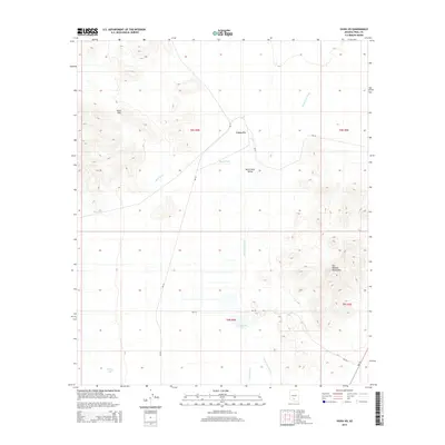
2014 Map of Vaiva Vo
USGS Topo · Published 2014About this map
Vaiva Vo sits at the heart of the Santa Rosa Valley in this desert study of Pinal County. The landscape is defined by its drainage patterns and water management, with the Santa Rosa Wash, Mesa Wash, and Kohatk Wash carving paths across the arid terrain. The presence of Lake Saint Clair and Antelope Tank highlights the vital importance of water storage for local survival and ranching in this corner of the Sif Oidak District. Topographically, the map is anchored by the Vaiva Hills in the northwest and the Tat Momoli Mountains to the southeast, illustrating the sharp rise from the valley floor. Transportation is primarily limited to Bureau of Indian Affairs routes such as Bia-42 and Bia-44, which connect the remote settlement to the broader region during this early 21st-century period.
Find a feature on this map
17 named features on this map. Tap any name to fly to it.
Don’t see what you’re looking for? This feature index may not catch every label — zoom into the map to look around manually.
Map Details
Editions of this 2014 Vaiva Vo Map
This is the sole edition of this map. No revisions or reprints were ever made.
Other maps of this area

1922 · Casa Grande
USGS Topo · 1:62,500

1924 · Casa Grande
USGS Topo · 1:62,500

1941 · Vekol Mountains
USGS Topo · 1:62,500

1942 · Silver Reef Mountains
USGS Topo · 1:62,500

1942 · Vekol Mountains
USGS Topo · 1:62,500

1946 · Antelope Peak
USGS Topo · 1:62,500

1948 · Antelope Peak
USGS Topo · 1:62,500

1953 · Ajo
USGS Topo · 1:250,000

1956 · Tucson
USGS Topo · 1:250,000

1957 · Ajo
USGS Topo · 1:250,000